")
Sub-Total: $0.00


Sierra Tahoe Region 4
$12.95
Description
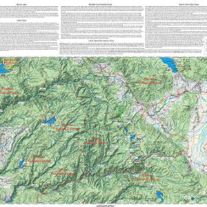
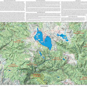
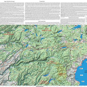
Sierra Tahoe Region 4 covers Rubicon River, Desolation Wilderness, South Lake Tahoe, South Fork American, Silver Creek, Truckee River, North Fork Cosumnes River, Silver Lake, Hope Valley, and Mokelumne Wilderness. Shows topographic relief, GPS Long./Lat., camping areas, road access, and trailheads. Special Features are Fishing Season and Regulations, Hatch Chart, Fish Identification, and Stream Etiquette guidelines.
The heart of this region are the many lakes of the Desolation Wilderness and the headwaters of the South Fork American River. Most of these waters contain Brookies with Rainbows are numerically a distant second. Browns can be found in some lakes. The region also includes the eastern slope waters of the West Carson. Most of the fish residing on the West Caron are Browns and Rainbows. Lahontan cutthroats have been recently planted. Maps to other regions outside of Sierra Tahoe Region 4 are available through the online store.