")
Sub-Total: $0.00


West Sierra Region 5
$12.95
Description
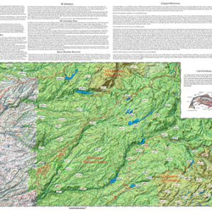
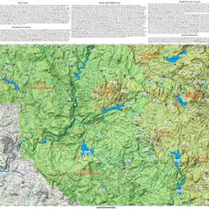
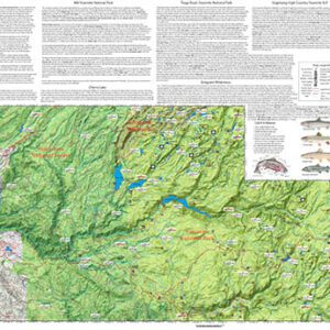
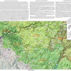
The West Sierra Region 5 map covers the Middle Fork Kings River, South Fork Kings River, Crown Valley, Kings River, Jennie Lakes Wilderness, and Roaring River. Shows topographic relief, GPS Long./Lat., camping areas, road access, and trailheads. The map has special features with Suggested Flies, Hatch Chart, Fishing Season and Regulations, Fish Identification, Catch & Release Procedures, and Stream Etiquette guidelines.
The Kings River dominates West Sierra Region 5 with Rainbows 14-15″ and Browns 18-20″ upstream of Garnet Dike. Other prime areas are the North Fork Kings below Wishon Reservoir. For other Regions and specific Lakes and Streams, go to the website.