")
Sub-Total: $0.00


Lower Kings River Map
$12.95
Description
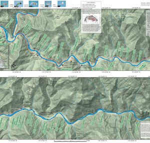
Lower Kings River Map covers the lower Kings River between Pine Flat Reservoir and Hwy 180 (E. Kings Canyon Road). Google map image showing topographical features. Sections of the river were identified with the assistance of Central Sierra Fly Fishing Adventures. Local guides, Fred Ramirez and Phil Davis, provided the location and names of specific sections with corresponding river structure. Also included is a hatch chart, mileage markers, road access, parking areas, nymphing rigs, Catch & Release Procedures, campgrounds, stream etiquette, and fishing regulations.
Choinumni Park and Winton Park are a good places to park and fish. Spring and Fall are the best seasons as the Summer gets busy with bathers. Both of these parks are in a “put & take” fishery with bait fishermen. Below Cobbles (Alta Weir), the section to the Hwy 180 bridge is catch & release only, barbless hooks. Avocado Lake park is a good place to park and fish. It is stocked with Rainbows in the Spring and Fall. The park gives access to the Kings River holding both Browns and Rainbows in the 12-16 inch class.
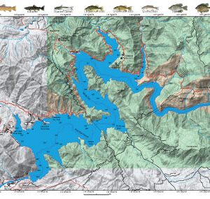
Other maps of the Kings River and Pine Flat Lake are found within the website.